Sold for A$40
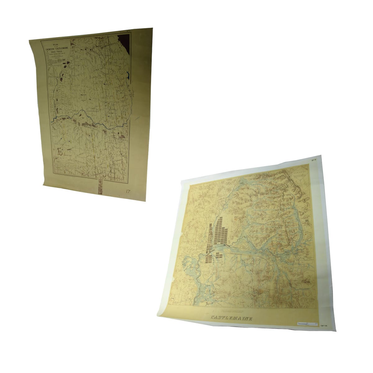
Two Old Maps of Chewton and Castlemaine Goldfields.. Ephemera. Maps. Two Old Maps of Chewton and Castlemaine Goldfields. 1. 500 mm across. 2. 800 mm across.. 1900s
N/A. (N/A). 1. Very Good. Has on it Mines Department Victoria, September 1902, Plan of the Chewton-Castlemaine Gold Field. Water courses have been coloured blue, reefs coloured yellow, etc., looks like ths was done after printing. Is rolled up, has typical folds and creases. 2. Very Good. Looks to be a copy, the print is a bit blurry. Map of Castlemaine by the Mining Department, Melbourne, November 6, 1861. Shows things such as pubs, police camps, etc, so is quite interesing. Also rolled up with associated creases and marks. A great pair of maps.. Estimate: $20-30